

Kështjella antike e Keqekollës
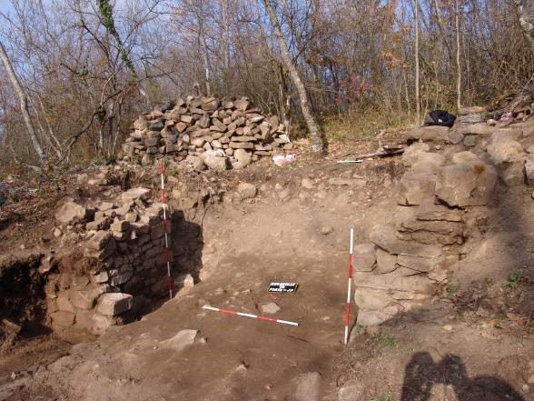
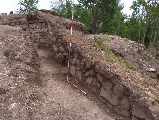
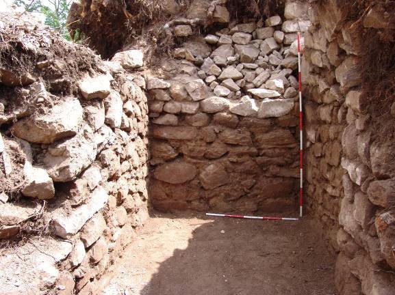
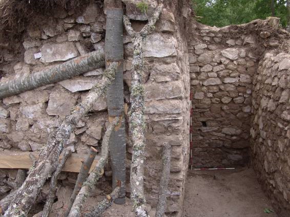
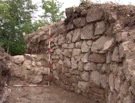
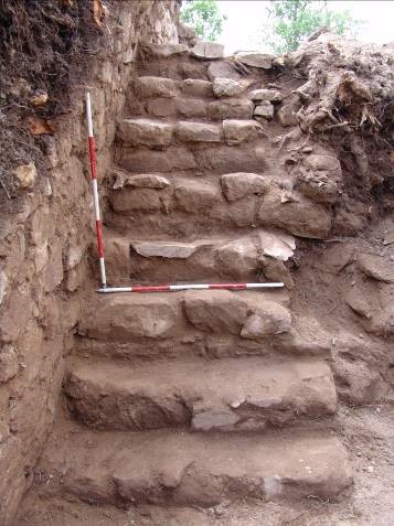
The Ancient Fortress of Keqekolla is located in the west of the village, at the place known as Gjytet and Kala, set on a hill with an exceptional strategic position at an altitude of 864 m. The fortress is bordered to the northeast by the mountain road that connects the mountainous and hilly terrain with the Keqekolla village. On the southern and eastern sides, it is bordered by the exterior walls of the surrounding walls. In the north the third levee borders with the protection gap. In the west, the castle is bordered by the ancient pathway. It has been fortified on all sides with medium and small rocks built on white lime mortar. On the north side of the tower the entrance of the first stage tower as well as a first quadruple stone staircase has been discovered. The main entrance to the fortress has been discovered on the western side of the castle, approximately at its centre, and side entrance on the northeast side. The main entrance, the entrance for carriages, is 3.20 m wide. On its southern side, the castle was protected by a rectangular tower erected in three phases. The height of the tower walls of the first phase is 4.20 m internally without reaching the ceiling, while from the outside the walls up to the ceiling reach the height of 4.70 m. The castle was built in the 4th-6th century A.D. not excluding the possibility of representing the Dardanian phases of the prehistoric times of bronze and iron, as well as the medieval phases of the 9th-11th A.D. It can be identified with the Kekola fortress, mentioned by the Procopius of Caesarea, the royal court historian of the Dardan origin emperor Justinian, in the work “De aedificiis” (on constructions) dating to the 6th century A.D. Based on its archaeological, artistic, social and scientific values, the Ancient Fortress of Keqekolla was proclaimed a site under permanent protection by the Kosovo Council for Cultural Heritage in 2016.
- Municipality: Prishtinë
- Coordinates: 42.736557 21.333040
- Date of announcement: 06.10.2016
- Perimeter of the asset: 5.30 ha
- Protected area: 53.25 ha
The map does not exist
Kosova Council for the Cultural Heritage © 2024